Out of Town Ride: Albuquerque to Jemez Springs (128 miles)
The Bosque Trail- Corrales- Rio Rancho- Santa Ana Pueblo- Zia Pueblo- San Ysidro- Jemez Pueblo- Jemez Springs
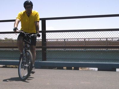
Every year I try to do at least one very long ride that takes me outside the metropolitan area. In past years I have ridden to Cedar Crest and Zia Pueblo. My longest rides have been about 80 miles in one day. This ride was from the west side near Coors rd and Central avenue to Jemez Springs and was 128 miles total.
I actually did this ride in July when it was about 95 degrees. I tried this ride last year but was unable to make it to Jemez Springs because of a strong headwind on the way to San Ysidro. On this day there was very little wind. The heat really did not bother me very much.
I began the ride on the west side of the city but I will just cover the route from the Santa Ana Casino from the Corrales- Rio Rancho post. If you need to see how I got there just refer to the Bosque trail and Rio Rancho-Corrales posts.
Santa Ana Pueblo to San Ysidro- 22 miles

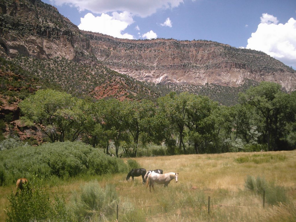
Sandoval County landscape
At this point I had already covered 23 miles since I left home. That route was mostly on designated bike lanes and trails. The route from Santa Ana casino to Jemez Springs is mostly on the shoulder of US route 550 and New Mexico Highway 4. I consider both of these roads to be safe bike routes. I believe US Route 550 is also known as State road 44. I appears on my maps as US 500.
Route 550 is a two lane highway and a major road from the Albuquerque to the northwest part of the state. It has a wide shoulder and is mostly free of debris. There is also a grooved rumble strip near the white line as to alert cars and trucks if they are veering onto the shoulder. Hwy 4 by contrast is a slow, winding road with a narrow shoulder.
The first five or six miles on Route 550 are uphill. It is a steady long, slow uphill ride in one of the higher gears. It heads in a generally northwest direction away from the Albuquerque metropolitan area. It will cross two Indian reservations on the way to the town of San Ysidro.
Somewhere around the crest of the hill the route passes by the Rio Rancho subdivision of Enchanted Hills. As the last house goes by the route leaves the Albuquerque metropolitan area and enters the desert of Sandoval county.
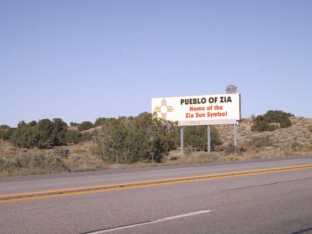
After the crest of the hill is a nice downhill ride. You do feel quite a breeze as the semi trucks pass by. Then the road begins to flatten out and stays mostly flat until San Ysidro. The first Indian reservation is Santa Ana Pueblo. The next reservation is Zia Pueblo which borders Santa Ana. There are 19 Pueblos in New Mexico and they are each considered to be a separate tribe. They speak speak several languages but most of the pueblos in the Albuquerque area are Keresan speaking. There are signs at the entrances to the pueblos that tell you more about the tribes.

After entering Zia Pueblo there is a billboard that reminds us that this is where the Zia sun symbol originated. The Zia symbol is the red sun symbol on the flag of New Mexico.
Further down the road is a gas station on Route 550 near the entrance to Zia Pueblo where you can refill your water bottle and take a rest. I forgot to mention that once you leave the Santa Ana casino area near the intersection of routes 550 and 528, there is a 17 mile stretch with no place to get water. You had better fill up before you leave.

After leaving Zia Pueblo is a historical marker about the Spanish explorer Francisco Vasquez de Coronado. He and his expedition traveled along this very route in 1541 on their way to their winter camp near what is today the town of Bernalillo.
After Zia Pueblo is the town of San Ysidro where the next section of the ride begins. It is also the end the flatness of Route 550. The next twenty miles or so to Jemez Springs are almost all uphill.
San Ysidro to Jemez Springs- 20 miles
San Ysidro is at the entrance to Jemez canyon which cuts into the Jemez mountains. The route is mostly a two-lane winding road. There is a shoulder with adequate room and the traffic is not very heavy and travels at low speed. This section takes you through some spectacular scenery and three distinctly different towns.
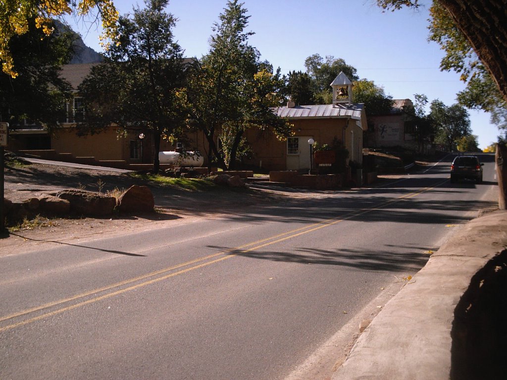
The first town is San Ysidro, which is a small Spanish village. There really isn't a town there but a collection of houses that are spread out along Hwy 4. San Ysidro has a rural feel to it with horses and plenty of open space. Some residents make the commute into the Albuquerque area to work.
San Ysidro Church

The second town is Jemez Pueblo. It is known as Walatowa in the Indian language. The most impressive feature are the red rock cliffs just north of the pueblo. The earth suddenly changes from light brown to a vivid red color. It only lasts for a half a mile or so and then it changes back. There are usually some food vendors selling fry bread at this location if you need to load up on calories for the ride back.

The third is Jemez Springs which is somewhat of a retreat village. It is most famous for its bath houses, restaurants and bed and breakfasts. There are some religious retreats including a Buddhist center. Jemez Springs makes a good weekend getaway from Albuquerque and Santa Fe.
As I said earlier, the route from San Ysidro to Jemez Springs is a slow, winding route. It goes through Jemez Canyon along Jemez creek. The canyon is quite narrow in some locations and is very colorful almost everywhere. The canyon floor near the creek is lined with cottonwood and aspen trees.

The uphill ride to Jemez Springs is about 20 miles but is actually easier than is seems. There are a few steep hills here and there but the climb is spread out over a distance. Every few miles there are rest areas where you can pull over and rest. These are actually called Fishing Access areas. Anglers can pull off here during the day and try to hook a trout or two. There are restroom facilities at the Fishing Access areas but no place to fill your water bottle.
It felt good to see the Jemez Springs city limit sign which meant I had finally accomplished my goal which I was unable to do the year before. I stopped at a grocery store and had something to eat and bought a few bottles of sports drink. It was about one o'clock when I had reached Jemez Springs and I only rested for a half an hour. I was anxious to begin the journey back to Albuquerque. Besides the route would be going down hill for the first few miles.
The Return Trip
There was one especially difficult section of the route. It was just north of the Jemez Valley High School. A section of Hwy 4 makes a very steep dip. It wasn't difficult on the way up but coming back the sun was very intense and I had already been riding for about 6 hours. I attacked the hill standing up on the pedals and it worked quite well. I was very winded at the crest of the hill but was able to recover quickly. There was one more big hill on the way back to San Ysidro but it wasn't as difficult. After that it was mostly downhill.
I did come across a pack of mangy dogs on the Jemez reservation. They didn't bother me but it made me think that I might want to bring some pepper spray on the next out of town trip. In the five years I have been riding in the city I have never had trouble with dogs. Dogs or even coyotes might pose a problem when riding through the desert. I may bring a cell phone also.
I passed through San Ysidro and began the return trip to Rio Rancho on Route 550. Just south of San Ysidro is a white bluff about a quarter of a mile off the road. I think it is a gypsum mine.

Gypsum mine
I stopped and rested at the gas station at Zia Pueblo. It is called the Big Chief gas station. So much for political correctness. I bought some more liquid for the trip to Rio Rancho. I also bought a gallon of cold water and went to the side of the store and poured it over my head. I felt really good as the heat was starting to take it's toll on me.
As I mentioned earlier, there was a nice downhill ride after climbing a hill after leaving Rio Rancho. Well, this downhill is now uphill. As I headed to Jemez Springs I made a mental note of every downhill. Each downhill means an uphill climb on the way back. The climb on Route 550 was the most difficult of the ride because I was now beginning to tire. I had been on my bike for nearly 8 hours by this time.
But I managed to climb the hill and coasted down the other side to Enchanted Hills. I cut through one of the neighborhoods and was back on Route 528 and back into the Albuquerque metropolitan area. I was once again on familiar ground. I usually do the Rio Rancho- Corrales ride at least once a month. I traced the route back through Corrales and then onto the Bosque Trail.
When I entered the Bosque Trail I knew I was getting close to the end. It is only about 12 to home from the Alameda Trailhead. I also knew that the trail is mostly flat and would be able to conserve my energy. The only real obstacle left was the climb up the West Mesa at Pat Hurley park.
I arrived at home tired but with a feeling of accomplishment. After five years of serious bicycling, I had finally completed my first Century (100 mile) ride. This ride was a total of 128 miles. My odometer said 65 miles when I reached the grocery store at Jemez Springs. Somewhere on the way back I lost 2 miles. I think it may have been where I cut through Enchanted Hills.
I dont' know what next year's long ride will be. I am thinking of a ride to the top of Sandia Crest. I almost did this one last year also. I am also thinking of a ride down the valley to Bosque Farms.
I will scope out these routes this winter and see if they are safe rides.
Thanks for checking back
-Brian
See these websites for more information:
Jemez Mountain Trail
Indian Pueblo Cultural Center
posted by Brian at 11:35 AM
2 comments
![]()