The Bosque Trail
Alameda Wetlands - Paseo del Norte trail - Montano bridge overlooks - Rio Grande Nature Center - Albuquerque Biological Park - Route 66 - Tingley Aquatic Park - Rio Grande Zoo - National Hispanic Cultural Center - South Valley - Rio Bravo loop
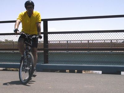
The Bosque Trail is without a doubt the most popular recreational trail in Albuquerque. It is the backbone of the city bicycle trail system. There is no better trail if you are a beginner because it is almost completely flat. More experienced riders still find it an enjoyable ride. It is also one of the safest trails due to the fact that it is almost all recreational trail and there is very little street riding involved. The trail can be ridden in sections or in one continuous loop. There are entrances and exits every few miles along the trail.
It runs along the Rio Grande from the northern edge of Albuquerque to deep in the South Valley. The Rio Grande is one of the great geographical features in North America. It flows from Colorado through New Mexico then along the Texas-Mexico border to the Gulf of Mexico. Even though it runs through a metropolitan area of three quarters of a million people it still manages to preserve its natural beauty. The bosque (roughly pronounced bose-kay) is a Spanish word meaning forest or park land. The woods are made up of deciduous trees like cottonwoods, salt cedar and Russian olives. There is quite a lot of wildlife in the area with roadrunners, pheasants, quail, rabbits, squirrels, lizards and a few snakes. Spring is an especially good time to ride in the bosque. The plants and trees are in bloom and it gives off a pleasant fragrance. The fall is also a good time ride with the changing foliage.
Please keep in mind that this is a multi-use trail which is used by cyclists, in-line skaters, pedestrians and equestrians. Please be especially careful of small children on bicycles.
You may want to refer to the bike trail map
of the Albuquerque trail system on the City of Albuquerque website.
You may have to use the zoom tool to get a better look.
The wetlands at the Alameda trailhead
Alameda Blvd to Paseo del Norte – 1.1 miles
There are many places to access the trail but for the sake of simplicity the best place to start is at the Alameda blvd. end of the trail. This is really the natural starting point of the trail and you may want to try beginning here first. The Alameda entrance has a parking lot and many cyclists find this to be a good place to start riding. The entrance to the parking lot is on east bound Alameda blvd before you reach Rio Grande blvd.
Just as you leave the parking area, you will see an area called the Alameda-Rio Grande Wetlands. This is an area set aside as a nature preserve of a Rio Grande wetlands from days gone by. It is not easy to get a good look because access is restricted from the trail but you can see some waterfowl and beavers.
The next sight on the trail is in the backyards of the semi-rural ranch homes of Los Ranchos de Albuquerque and the North Valley. You can see horses, burros, goats and other farm animals in these backyards. One backyard in particular has several llamas, ostriches and camels. This backyard is south of the Alameda entrance and before the Paseo del Norte underpass. I don’t mean to invade the privacy of the residents but this is quite an unusual sight.

Camel
This is the shortest section of the bosque trail and you will come upon the Paseo del Norte underpass very quickly. There are underpasses at all of the major intersections so you won’t have to cross any streets. Please be mindful of equestrians in the tunnels. If a horse and rider are in the tunnel before you, let them pass before proceeding. Horses can get spooked by a fast moving bicycle.
Paseo del Norte is good place to enter the trail as well. There is a trail that runs parallel to the street that connects with other trails. There are also parking lots both east and west of the bosque trail. The Paseo trail west only goes about one mile to a parking lot near the Southwest Indian Polytechnic Institute (SIPI) campus. You can connect to the bike lane on Coors Blvd from here.
The Paseo trail heading east is a very good trail. There is a parking lot near Rio Grande blvd. The trail heads east along Paseo del Norte towards the mountains as far as the General Mills cereal plant and then turns south towards the University of New Mexico campus.
Paseo del Norte to Montano road – 3.2 miles
The trail from Paseo del Norte to Montano road is one of the longest stretches of the Bosque trail but has very few landmarks or unusual sites. The terrain is very flat and I tend to concentrate on getting a good physical workout on this section. However, there is plenty of unspoiled bosque along the way.
The trail between Paseo del Norte and Montano road
The trail then passes under Montano road, which is another place to enter and exit the trail. It is also a good place to stop and rest. In particular, the Montano Bridge Overlooks provide the best view of the river anywhere on the trail.
The Rio Grande from the Montano bridge
The Rio Grande is a wide river but very shallow. It is only a few feet deep when it is at its highest level and sometimes almost dries up completely. It always has a smooth chocolate milk color which contrasts against an almost always blue sky.
Rio Grande Overlook
The three overlooks are a good place to rest and see the river. They are located on the south side of Montano road. There are plaques on the overlook that have information about the bosque ecosystem. The Rio Grande is a major migration route for birds in the winter and spring.
This trail is separated from the road by a concrete barrier. The north side of the road has a designated bicycle lane as does the south side. The Montano Bridge is quite a work of art in itself. It has a light-brown adobe color with various colored blue painted tile-like squares. There is a new parking lot on the western side of the bridge accessible from Montano road just east of Coors road.
The trail in the eastern direction does not go very far. I would not recommend cycling on Montano road any farther than 4th street. The bike lane ends there with no safe place to ride. There is a bicycle lane on Rio Grande blvd that you can take all the way to Old Town. Rio Grande Blvd has a good place to refill your water bottle. It is the Flying Star café about ½ mile south on Rio Grande Blvd. I recommend the lemonade. You can sit out on the patio, where patrons are allowed to bring their dogs. There is a bike rack at the front entrance.
The bosque trail continues along the river towards Central Avenue. The next landmark on the trail is the Rio Grande Nature Center about a mile and a half south of Montano road. The center is a living outdoor museum about the bosque ecosystem and is a worthwhile stop on the trail.
There is a bike rack just off the trail near the building. It is also accessible from Candelaria road west of Rio Grande blvd.
Rio Grande Nature Center
You will see some windows near the entrance to the center. They provide a view of Rio Grande wetlands with waterfowl, turtles and plant life of the bosque.

The Pond
Inside the building are exhibits about the animal and plant life in the bosque.
There is one room called “the library” which has what looks like a lounge with sofas and chairs and bookcases. The library overlooks the wetlands pond and has a speaker system so you can hear the sounds of the bosque.
The Library
The Nature Center also has an exhibit about the bosque restoration that has been taking place for the last year or so. You may have noticed that certain areas of the bosque are barren and have charred stumps and cut down trees. This is due to a project to restore the bosque to its original condition as much as possible. There was also a severe brush fire in the bosque around this area two years ago that did a lot of damage.
As you leave the Nature Center there is some construction taking place on the trail. This is part of the ongoing San Juan-Chama project which will bring more municipal water to Albuquerque. The trail detours change frequently so be alert. There is a trail entrance at Campbell road but it is closed at this time due to the construction. Campbell road connects to Rio Grande Blvd and Old Town.
The next underpass is Interstate 40. I did not include it as stopping point because it is not accessible by bicycle. I-40 is fine if you are driving from Wilmington, North Carolina to Barstow, California but it is of no use to a cyclist.
The next exit on the trail is Mountain Road which appears to be nothing more that a hole in the fence. The exit to Mountain Road is marked on the actual pavement. Mountain road will take you to Old Town rather easily. There is no bike lane but very little traffic either. Old Town is a good destination for cyclists wanting to see the city as I will discuss in later posts.
Botanical Garden
Then next place of interest is the Albuquerque Biological Park on Central Avenue. The BioPark is a complex made up of the Albuquerque Aquarium, the Botanical Garden and the Butterfly Pavilion exhibit. Like the Nature Center, the Botanical Garden is a good place to learn about the native plants of the Southwest. The Aquarium tends to focus on the Rio Grande's final destination, the Gulf of Mexico.
- Albuquerque Biological Park website

The Albuquerque Aquarium
You have now arrived at Central Avenue also known as Route 66, the mother road of America. This was a major east-west highway which went from Chicago to L.A. as the song goes. Route 66 was a migration route to California during the Great Depression. Many travelers like the Joads in The Grapes of Wrath passed by this location decades ago on their way to a better life. It was gradually replaced over the last few decades with several Interstate highways.
Route 66 sign
Route 66 is a linear community that runs through the city. It is one of Albuquerque's most significant features. For many people it brings back memories of a simpler time. Central Avenue is one of the best preserved sections of this highway of the past. However, it is a very good place to ride your bicycle. There are ways to access the sights of Route 66 from side streets and trails.
There is no parking available on the bosque trail at Central Avenue due to the reconstruction the Tingley drive intersection. The whole intersection is being rebuilt as part of the Tingley Aquatic Park construction on the south side of Central Avenue. However the bike trail still passes under Central Avenue as usual.
Central Avenue to Bridge Avenue – 1.9 miles
South of Central Avenue there is a construction zone for the renovation of Tingley Beach. Tingley Beach has been around since the 1930’s but has deteriorated in the last few decades and had become an unsightly mud hole. When it is completed this year, it will feature several ponds for model boats, fishing and wildlife. The beach will be renamed Tingley Aquatic Park. There have been few intrerruptions to bicycle traffic during contsruciton but be alert until it is completed.
Tingley Aquatic Park construction
The next landmark is the Rio Grande Zoo. Actually, all you can see is the back of the zoo. Sometimes you can look over the back wall of the exhibits and see the polar bears sunning themselves on the rocks. One feature of the Tingley Aquatic Park renovation will feature a miniature railroad. This railroad will travel from the Zoo through the Aquatic Park and to the BioPark connecting the three parks.
The white spot above the wall is the polar bear
Just before Bridge Blvd is a Sonic Drive-In restaurant. This is a good place to stop and get a cold drink on a hot summer day. I like the cherry limeade. They also have bottled water if you are running low. You can sit outside at the picnic tables and press the red button to order. They bring your order to you outside.
Also, keep an eye out for the Mexican ice cream men pushing their carts along Bridge avenue. A tamarind flavored Popsicle is good on a hot summer day. I gives you a chance to use your High School Spanish.
Bridge Avenue to Rio Bravo Blvd. – 3.3 miles
There is no real parking at the Bridge Avenue entrance to the trail. There is a dirt lot near the trail on the south side of Bridge Avenue but I don’t know who owns it. Sometimes there is overflow parking for the Hispanic Cultural Center when they have a big event. There is a bike lane on Bridge avenue that you connects to the trail.
Bridge Avenue marks the beginning of the South Valley of Albuquerque. The South Valley has a somewhat negative image in the Albuquerque area. It is mostly a lower-income and industrial section of the metropolitan area. Partly because of this image, this is the least traveled section of the bosque trail.
The South Valley in general is not very bicycle friendly. Much of the South Valley is outside of the city limits and does not benefit from the city trail construction projects. The bosque trail in this area is still a good and safe place to ride.
After you pass under Bridge Avenue, the first thing you will see is the National Hispanic Cultural Center. This center opened just a few years ago. This was considered a major civic project for the city. There are art exhibits, theater productions and concerts that are Hispanic related. I understand the center also has a Spanish language school that is run by the Government of Spain. I have not actually been inside yet but the outside architecture is quite impressive.

The Roy Disney Center for the Performing Arts at the National Hispanic Cultural Center
Just past the Cultural Center is another venerable Albuquerque institution, the Bueno Foods facility. Bueno manufactures and distributes New Mexican varieties of foods, like blue corn tortillas, posole, chiles and other spices. Mexican food is big business in this city.

Bueno Foods
There really isn’t much to see here but a bunch of old crates and machinery through a barbed wire fence. Some days when you pass by here you can smell roasting green chile or tortillas being baked. Although my blog is about seeing Albuquerque, the sense of smell is also a factor in enjoying your ride. I did mention earlier about the blooming vegetation.
The trail continues through the South Valley which is a mixture of rural and industrial scenes. You pass by fields of corn and alfalfa mixed in with fuel terminals, cement plants and lumber yards.
Plowed field in the South ValleyThe trail runs parallel to an irrigation channel. It crosses over it a few times throughout the journey. These channels are used to irrigate the farms of the valley. You will also see people fishing in it, especially in the South Valley. There is a good fishing pier near the Rio Bravo Riverside picnic area.
Fishing pier on the irrigation channel
The Rio Bravo Loop – 5.2 miles
The Rio Bravo entrance to the trail has parking near the Rio Bravo-Riverside picnic area. It is accessible by taking the Poco Loco road exit from Rio Bravo. You can also park near the fishing pier.
The bosque trail is often described as a loop but it is more like a hangman’s noose. It is a straight trail from the beginning at Alameda blvd to Rio Bravo The trail then continues south and loops back to the Rio Bravo picnic area. You can then ride the trail in reverse back to Alameda blvd.
The Rio Bravo loop is not a very scenic part of the trail. As I said earlier, the South Valley is the least traveled section of the bosque trail. Many cyclists do turn back at Rio Bravo blvd but the loop is only 5.2 miles long. If you really want to see the city, you may want to see some of the unsightly areas as well as the attractive areas.
The next “sight” is the municipal waste water treatment plant. The city takes water out of the Rio Grande upriver and has to treat it before it puts it back downriver.
Waste water plant
The trail then reaches a point where in no longer travels south along the river. It begins its loop back to Rio Bravo. It actually does leave the bosque area and head east towards the mountains. The Sandia Mountains act as a natural built-in compass. They are due east of the city and can be seen from almost anywhere is the city unless you are in a grove of cottonwood trees.
The trail runs along an arroyo (cement drainage ditch) which usually has a lot of graffiti. The city of Albuquerque has become more aggressive with cleaning up graffiti in recent years but I believe this area is outside the city limits.
There is an exit to 2nd Avenue to the Mountainview neighborhood but this is not a good place to exit the trail. There are no bike lanes or trails along 2nd Avenue or in the area. The streets are also bumpy and irregularly paved and I don’t recommend them for riding. The reason I mention this exit is that there is a store near the exit where you can refill your water bottle.
The trail then passes under 2nd Avenue and then starts to head back north towards Rio Bravo blvd. This is the southern-most point of the trail. It extends as far south as the Journal Pavilion concert venue. This will give you an idea of how much distance you have covered since leaving Alameda blvd. The trail then passes by several junkyards and the Duke City Raceway. You also get your first sight of the Albuquerque skyline. 
Rio Bravo shelter
You will find a shelter where the trail meets up with Rio Bravo blvd. The shady side of the shelter has a bench where you can sit and see a public work of art called “Spinning”. It is a bas-relief of a cyclist. I’m not sure but I believe the shelter was built as a memorial of a cyclist was hit by a motorist. Sometimes you will see votive candles and luminaries (paper lanterns) on the bench.

Spinning
From this point the trail heads back to the Rio Bravo picnic area along the south side of the street. The trail does cross several streets and then runs on a frontage road for a short distance. You are now back to the Rio Bravo picnic area and are now ready to do the trail in reverse. Or you can take the trail to one of the exits and start off on a new ride.
This post was rather long due to the size and importance of this particular trail. I do expect future posts to be shorter. Thanks for checking back and enjoy your ride.
The future of the bosque trail.
It was announced earlier this year that the bosque trail will be expanded several miles outside the Albuquerque area. The plan is to extend the trail along the bosque to the town of Bernalillo on the north end and to the town of Belen on the south end. The actual route has not been planned yet but this extension should make the trail nearly fifty miles in length! Most of this expansion area will be in unspoiled, lightly populated areas.
The expansion is a combined city and state effort. It was announced by Mayor Martin Chavez and Governor Bill Richardson. I believe the plan is to have it completed sometime is 2006. There is some negotiating to be done with property owners and Indian tribes. If this does happen, it may make the bosque trail one of the best municipal bicycle trails in the country.
-Brian
posted by Brian at 9:52 PM
254 comments
![]()